First of back-to-back atmospheric rivers drenches Northern California while moving south
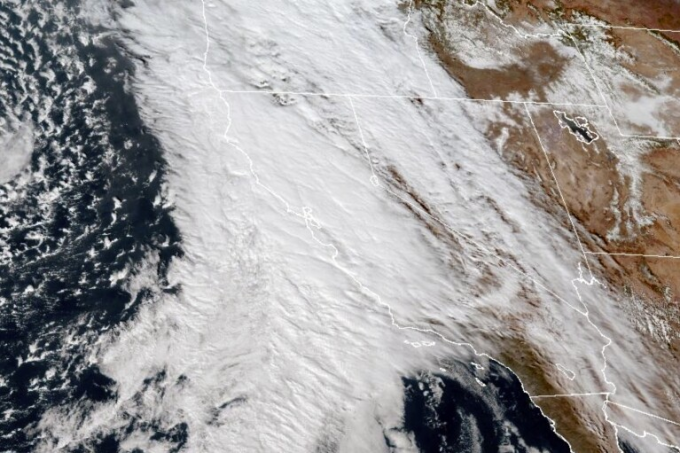
LOS ANGELES — The first of two back-to-back atmospheric rivers drenched Northern California on Thursday, flooding roads while triggering statewide storm preparations and calls for people to get ready for powerful downpours, heavy snow and damaging winds.
Heavy rain and gusty winds that began hitting the San Francisco Bay Area on Wednesday evening were expected to continue powering down the coast, according to the National Weather Service.
The weather service issued a flood watch into Friday morning for the Bay Area and the Central Coast because of possible flooding of rivers, streams, some roads and areas scarred by previous wildfires.
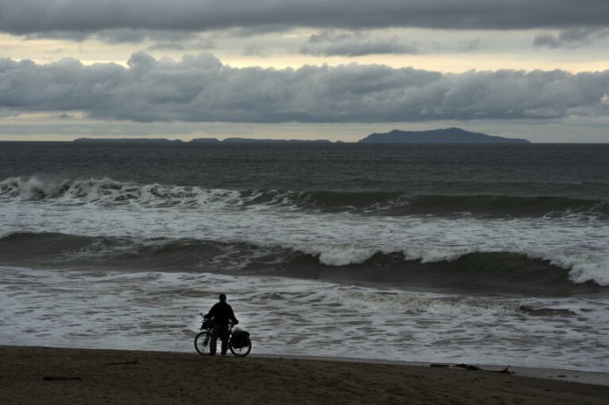
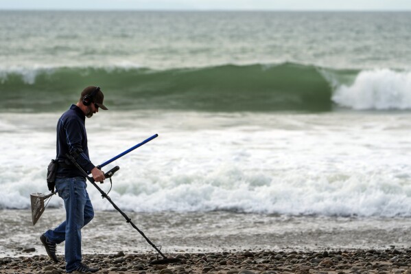
Forecasters also said the Central Coast could see waves up to 18 feet (5.4 meters) high on Thursday and Friday.
Service on San Francisco’s iconic cable cars were halted as a safety precaution, and Pacifica, a coastal city in San Mateo County, saw more than an inch (2.5 centimeters) of rain in a single hour.
Widespread coastal flooding was reported Wednesday in Humboldt County, where up to 2 inches (5 centimeters) of rain was expected before the storm headed south, said the National Weather Service office in Eureka. Scattered power outages were reported.
In the far south, all of San Diego County was under a flood watch Thursday. Forecasters said some areas could see 2 inches ( 51 milliliters) of rain, with up to 3 inches ( 76 milliliters) in the mountains and winds gusty to 40 mph or more.

The storm came a week after heavy rain caused flooding that inundated homes and overturned cars in the county.
The “Pineapple Express” — so-called because its long plume of moisture stretched back across the Pacific to near Hawaii — will be followed by an even more powerful storm on Sunday, forecasters said.
The California Governor’s Office of Emergency Services activated its operations center and positioned personnel and equipment in areas most at risk from the weather.
Brian Ferguson, Cal OES deputy director of crisis communications, characterized the situation as “a significant threat to the safety of Californians” with concerns for impact over 10 to 14 days from the Oregon line to San Diego and from the coast up into the mountains.
“This really is a broad sweep of California that’s going to see threats over the coming week,” Ferguson said.
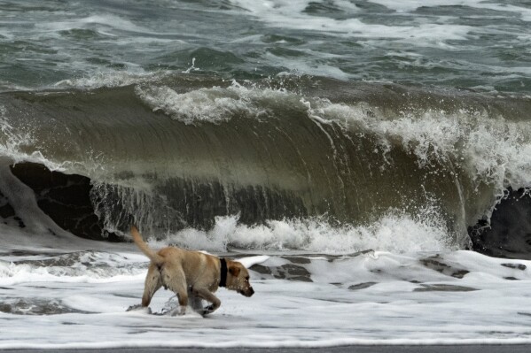
“Molly,” a Labrador Retriever plays on the edge of waves ahead of storms in Ventura, Calif., Wednesday, Jan. 31, 2024. ( Photo/Damian Dovarganes)
Last winter, California was battered by numerous drought-busting atmospheric rivers that unleashed extensive flooding, big waves that hammered shoreline communities and extraordinary snowfall that crushed buildings. More than 20 people died.
The memory was in mind in Capitola, along Monterey Bay, as Joshua Whitby brought in sandbags and considered boarding up the restaurant Zelda’s on the Beach, where he is kitchen manager.
“There’s absolutely always a little bit of PTSD going on with this just because of how much damage we did take last year,” Whitby said Wednesday.
The second storm in the series has the potential to be much stronger, said Daniel Swain a climate scientist at the University of California, Los Angeles.
Models suggest it could intensify as it approaches the coast of California, a process called bombogenesis in which a spinning low-pressure system rapidly deepens, Swain said in an online briefing Tuesday. The process is popularly called a “cyclone bomb.”
That scenario would create the potential for a major windstorm for the San Francisco Bay Area and other parts of Northern California as well as heavy but brief rain, Swain said.
The new storms come halfway through a winter very different than a year ago.
Despite storms like a Jan. 22 deluge that spawned damaging flash floods in San Diego, the overall trend has been drier. The Sierra Nevada snowpack that normally supplies about 30% of California’s water is only about half of its average to date, state officials said Tuesday.
A winter storm warning was in effect through 10 a.m. Friday for nearly a 300-mile (483-kilometer) stretch of the Sierra from north of Lake Tahoe to south of Yosemite National Park, said the weather service office in Reno, Nevada. Snow could fall at rates up to 2 inches (5 centimeters) per hour in some areas, with winds gusting up to 100 mph (160 kph), forecasters said.
Disclaimer: The copyright of this article belongs to the original author. Reposting this article is solely for the purpose of information dissemination and does not constitute any investment advice. If there is any infringement, please contact us immediately. We will make corrections or deletions as necessary. Thank you.
Read More

Ukraine, Russia fight from the skies as Kyiv’s EU aid hangs in the balance
The European Union is gripped by a crucial summit on Thursday that will be dominated by a second att...
First of back-to-back atmospheric rivers pushes into California. Officials urge storm preparations
LOS ANGELES — The first of two back-to-back atmospheric rivers slowly pushed into California on Wedn...

Israel and Lebanon are prepping for a war neither wants, but many fear it’s becoming inevitable
BEIRUT — The prospect of a full-scale war between Israel and Lebanon’s Hezbollah militia terrifies p...
Federal judge dismisses case seeking to force US to pressure Israel to stop bombing Gaza
OAKLAND, Calif. — A U.S. district judge in California dismissed a lawsuit Wednesday that sought to f...
Barcelona edges Osasuna 1-0 in 1st match since coach Xavi announced his decision to leave
MADRID — With coach Xavi Hernández still in charge, Barcelona got back on track with a 1-0 win over ...

Russia-Ukraine war: List of key events, day 708
Here is the situation on Thursday, February 1, 2024. Fighting A Russian bomb hit a hospital in north...