Mapping the scale of Canada’s record wildfires
Canada is experiencing its worst wildfire season on record with tens of thousands of people being driven out of their homes and the federal government forced to deploy the military to several regions over the past months.
Nearly 200 homes and structures have been lost or damaged by the wildfires burning in Kelowna, British Columbia. Cooler conditions have brought some relief to the region even though smoke continues to blanket the country’s westernmost province.
While Canada experiences fires every summer, this year’s blazes have scorched at least 15.3 million hectares (37.8 million acres) of land, nearly 10 times more than 2022 and roughly the size of New York state.
According to the Canadian Interagency Forest Fire Centre (CIFFC), 1,036 active fires are burning throughout Canada with 652 categorised as “out of control”, 161 as “being held” and 223 considered to be under control.
Where are the wildfires burning?
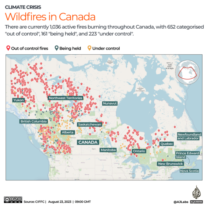
About two-thirds of all active fires are burning in the western province of British Columbia (376) and in the Northwest Territories (237). An additional 143 fires are burning in Yukon, 88 in Alberta and 66 in Ontario.
According to the CIFFC, 5,881 fires have been recorded across the country this year so far, about 1,000 more than last year.
How much area has burned?
The land that has burned this year so far is more than double the size of the United Arab Emirates and triple the size of Costa Rica.
To put the 15.3 million-hectare figure into perspective, an area of 1 million hectares is the same as 10,000 square kilometres. That means the fires have burned 153,000sq km, or 59,000 square miles.
This year’s fires have now burned more than double the previous record of 7.1 million hectares torched in 1995.

British Columbia wildfires
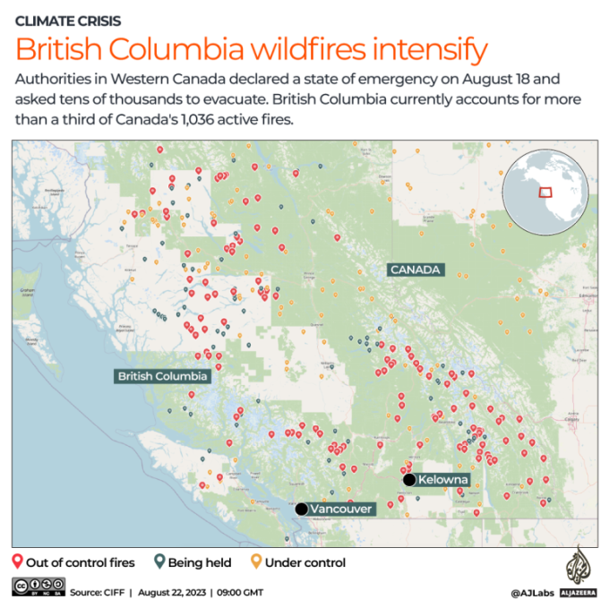
British Columbia declared a state of emergency on August 18 as a fire in the southern part of the province grew more than a hundredfold in 24 hours. More than 35,000 people were asked to evacuate their homes.
The fire is centred around Kelowna, a city of 150,000 people located more than 350km (217 miles) east of Vancouver. Sections of some key transit routes between the Pacific coast and the rest of western Canada have been partially shut down.
Nearly 1,900 fires have scorched 1.7 million hectares (4.2 million acres) of land in British Columbia this year so far. This has led to hazardous levels of air quality across many parts of the province.
Fires across the Northwest Territories
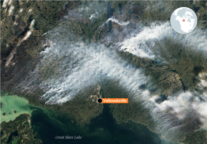
Another devastating blaze has threatened Yellowknife, capital of the Northwest Territories.
On August 15, authorities issued a state of emergency there as more than 200 wildfires burned across the territory in northern Canada. All 20,000 of Yellowknife’s residents were asked to evacuate by air or land as firefighters battled the flames.
About 270 fires have burned more than 3.4 million hectares (8.4 million acres) across the Northwest Territories, according to the CIFFC.
Disclaimer: The copyright of this article belongs to the original author. Reposting this article is solely for the purpose of information dissemination and does not constitute any investment advice. If there is any infringement, please contact us immediately. We will make corrections or deletions as necessary. Thank you.
Read More
Floods force evacuation of almost 100,000 in Pakistan
Families waded through water and cattle were loaded onto boats in a mass evacuation of around 100,00...
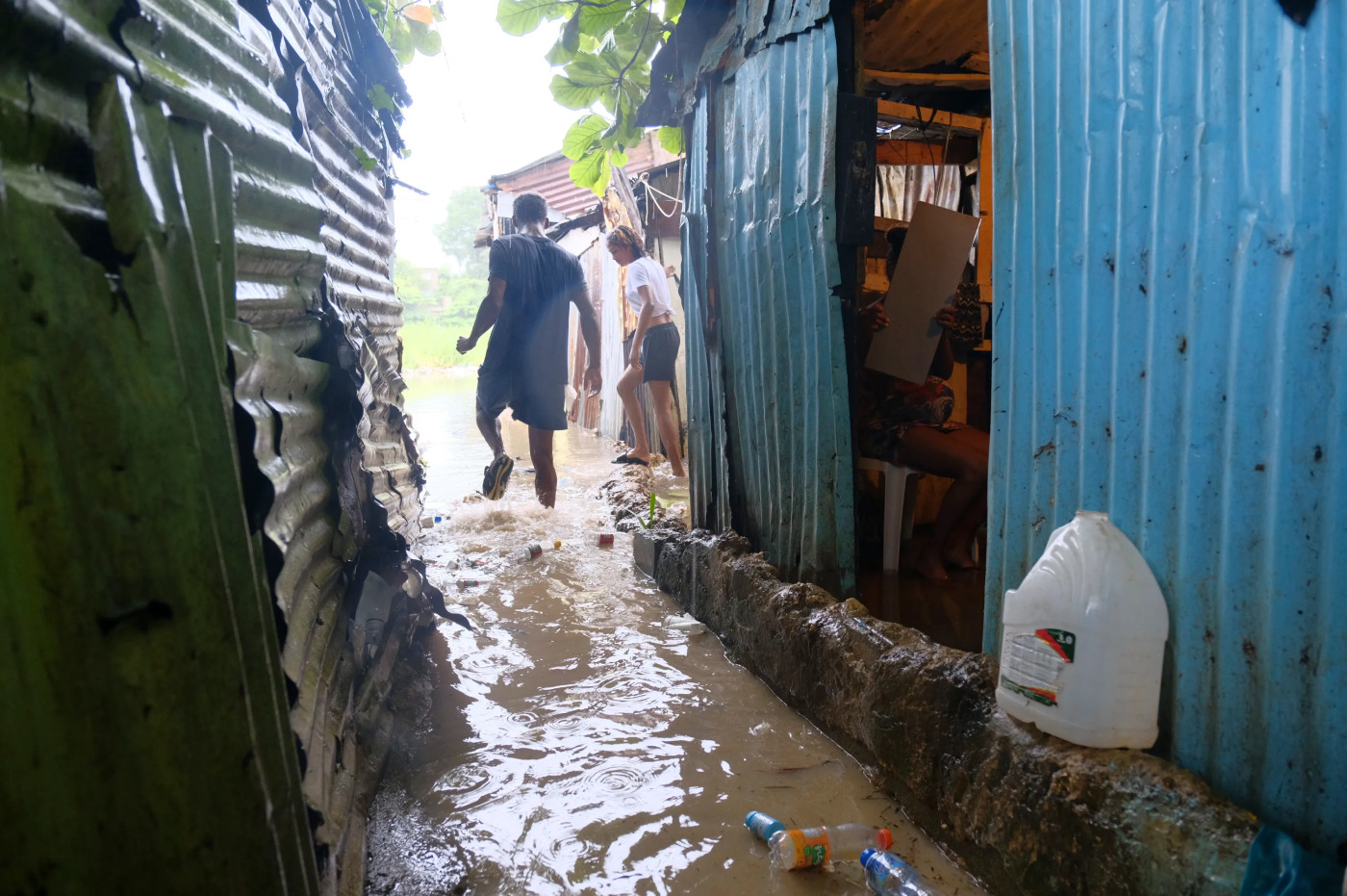
Dominican Republic: Authorities assess damage from Tropical Storm Franklin
Authorities in the Dominican Republic are fanning out across the Caribbean country to evaluate the d...
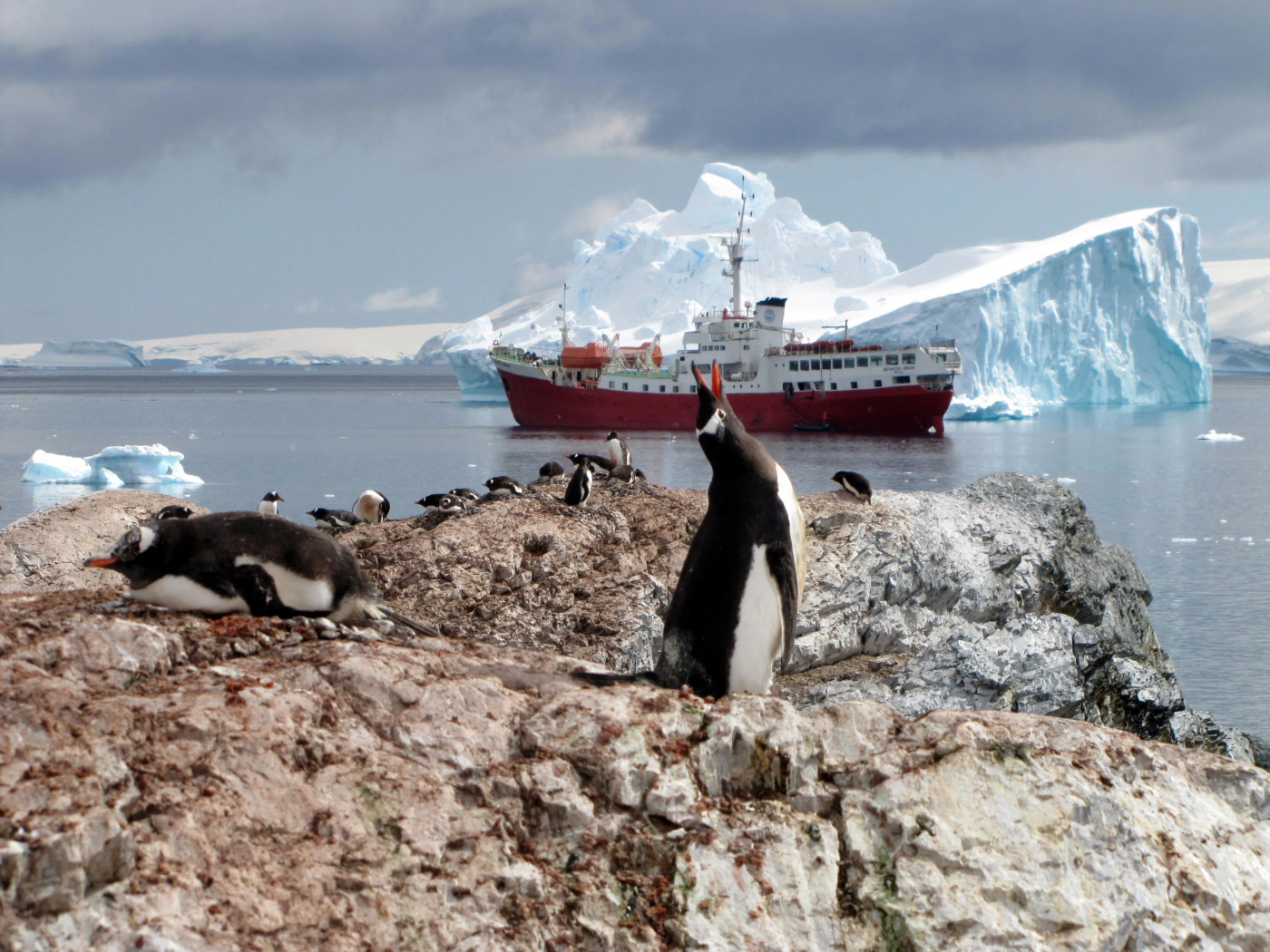
Warming decimates Antarctica’s emperor penguin chicks
Helpless emperor penguin chicks perished at multiple breeding grounds in West Antarctica late last y...

Q&A: Maui wildfires ‘an acceleration of injustices’ long felt on island
A massive wildfire driven by hurricane winds scorched communities across Hawaii’s Maui island this m...
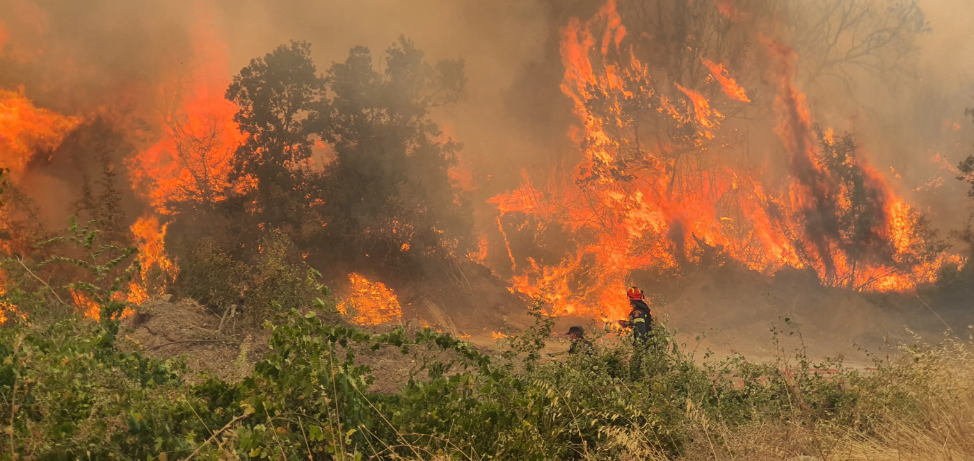
‘All my fortune was there’: Fires devastate Greek livelihoods and wildlife
Alexandroupolis, Greece – Vagia Arvaniti wept for her livestock as she lifted the corrugated sheet m...
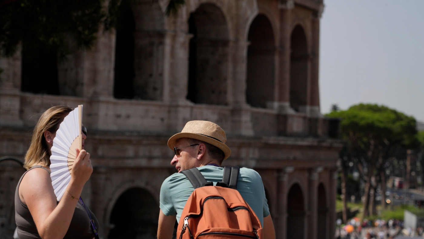
Rome: As hot as always
Through the centuries, Rome has survived extreme weather and natural disasters – from earthquakes an...